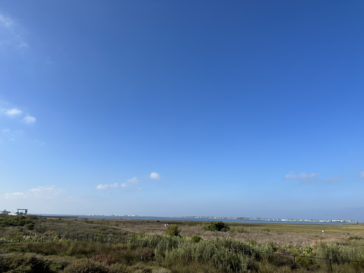
San Diego Bay
San Diego Bay is a natural harbor and deepwater port. It is the third largest of the three large, protected natural bays on California’s coastline, after San Francisco Bay and Humboldt Bay. The highly urbanized land adjacent to the bay includes the cities of San Diego, National City, Chula Vista, Imperial Beach, and Coronado.
The San Diego Bay Watershed is the largest Watershed Management Area (WMA) located entirely within the boundaries of San Diego County and includes three major subwatersheds: Pueblo San Diego, Sweetwater, and Otay. The entire San Diego Bay WMA covers over 888,400 acres. Major water bodies include San Diego Bay, Otay River, Sweetwater River, Chollas Creek, and Paradise Creek. Historically, the San Diego River sometimes shifted its outlet to San Diego Bay, but that is now prevented by levees that confine the river channel.
San Diego Bay is the largest estuary in San Diego County and has been extensively developed as a port. It is comprised of 10,532 acres of water and 4,419 acres of tidelands. Only 17 to 18 percent of the original Bay floor remains undisturbed by dredge or fill. Ninety percent of the original salt marshes and 50 percent of the original mudflats have been filled or dredged for development. Construction of dams and extensive use of groundwater in the Sweetwater and Otay Rivers has reduced the input from these rivers to the Bay by 76 percent. The majority of freshwater input to the Bay is from surface runoff from urban areas and intermittent flow from rivers and creeks during rain events.
Land use in the watershed is primarily Undeveloped, Residential, and parks and recreation. San Diego Bay is recognized for protection by the California Bays and Estuaries Policy.
The Northern part of the bay is heavily developed and is outside the scope of this project.
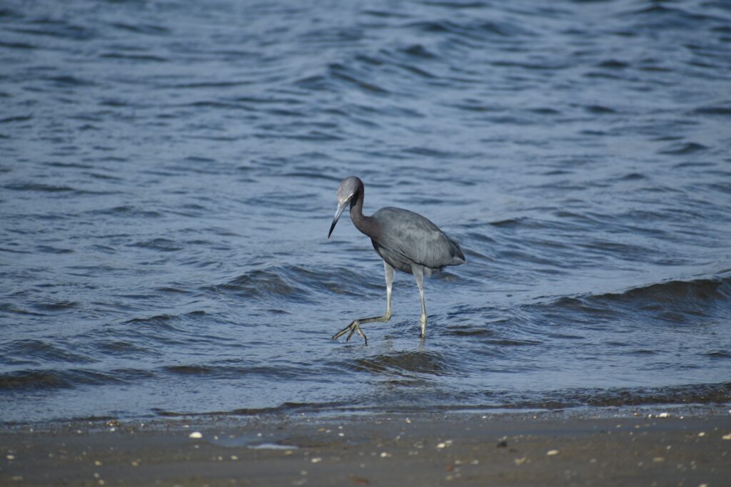
The shallow southern end of the bay is used for evaporation ponds to extract salt from the seawater. The salt ponds, the Sweetwater Marsh, and other areas of the bay are included in the San Diego National Wildlife Refuge Complex. The refuge consists of about 2620 acres of land and water and includes the largest contiguous mud-flat in Southern California. It is an important stop on the Pacific Flyway for migrating birds, and it supports numerous endangered and threatened species of plants and animals. The Refuge consists of the Sweetwater Marsh and South San Diego Bay Units. What remains of San Diego Bay’s historic coastal salt marsh and intertidal mudflat habitat is preserved within these two Refuge Units.
The salt marshes are by far the most prominent habitat and support juvenile fish and invertebrates while providing nesting, foraging, and high-water refuge for many different species of birds. The additional native habitats on the unit are intertidal mudflats, salt ponds, and a shallow subtidal habitat. These spaces provide resting and foraging habitats for various birds, and the levees surrounding the ponds also offer important nesting habitat spaces for seven species of ground-nesting seabirds.
The Port of San Diego manages the harbor and administers the public lands adjacent to the bay. The US Fish and Wildlife Service manages the wildlife refuge.


Wetland Expansion Potential
Wetland Migration
The potential for wetland migration is extremely limited by existing development. The best potential appears to be the area formerly occupied by the power plant and adjacent vacant land just south of the Chula Vista Marina. The Otay Valley Regional Park will allow some expansion south of the Otay River channel.
The unique wetland habitat of the salt ponds will gradually disappear as that area is inundated. With proper management, it could be converted into eelgrass beds.
Constraints
The wetland expansion potential is highly constrained by existing development. Most of the perimeter is urbanized and much of the shoreline is armored.
Wetland Restoration
Pond 20 Restoration
The Port of San Diego is proposing to construct 76.5 acres of coastal wetland habitat at Pond 20 to create a mitigation bank, the first of its kind for San Diego Bay. Pond 20, a former salt evaporation pond in south San Diego Bay, is currently vacant, isolated from tidal influence, and provides little habitat value due to its salt-encrusted surface and invasive plants. The wetland mitigation bank at Pond 20 would be a future catalyst supporting valuable ecosystem services such as protection from storm surges and erosion, increased biodiversity, improved water quality, increased carbon sequestration capacity, and more, while also providing pathways for additional wetland mitigation banks.
Otay River Estuary Restoration Project
The Otay River Estuary Restoration Project will restore approximately 125 acres of coastal wetland and upland habitats at the south end of San Diego Bay within the San Diego Bay National Wildlife Refuge for the benefit of native fish, migratory birds, and other coastal-dependent species.
Restoration will occur at two locations within the Refuge: on approximately 34 acres located east of 13th Street near Imperial Beach within the Otay River Floodplain; and approximately 91 acres of an existing solar salt pond (Pond 15) generally located to the west of the intersection of Bay Boulevard and Palomar Street in Chula Vista.
Public Access
Trails
There is limited access at the Sweetwater Marsh Unit of the San Diego Bay NWR. Public access to the bay and wetlands, with walking trails and educational exhibits about the area’s ecological resources, is provided at the Living Coast Discovery Center, a nonprofit zoo and aquarium located on the San Diego Bay National Wildlife Refuge. It is open to the public Wednesday through Sunday, 10:00 AM-5:00 PM. A network of trails starting at the Center allows public access to the wildlife refuge.
Refuge visitors can catch a free shuttle from the Living Coast Discovery Center to access refuge trails about every 15 minutes. Check the LCDC website for days and times when the service is available. The center can only be reached by the shuttle. Private motor vehicles are prohibited within the refuge.
There is no fee to walk the 1.5 miles of trails. However, there is a fee to explore the Living Coast Discovery Center. Both the Discovery Center and USFWS administrative headquarters are located next to each other.
Biking
The Bayshore Bikeway is a 24-mile bicycle circuit, which includes about 13 miles of car-free bicycle paths. The rest of the route consists of on-street sections designated as either bicycle lanes or bicycle routes.
Starting Downtown take Flagship’s Coronado Ferry to the Coronado Ferry Landing. The Bikeway makes its way through Coronado, along the Silver Strand, through the communities of Imperial Beach and Chula Vista, and back into Downtown San Diego. The ride will take you through Coronado, past Silver Strand State Beach and the San Diego Bay National Wildlife Refuge. The continuous, paved portion of the rail trail ends at the south end of San Diego Bay at Main Street in Chula Vista. Bike lanes along streets with light traffic connect to another portion of trail near the S. Bay Freeway and over the Sweetwater River, connecting to the Sweetwater Bikeway. To complete the 24-mile loop around the bay, the trail links with on-street bike lanes and bike routes through Chula Vista, National City, and downtown San Diego.
Transit
The shuttle stop for the Living Coast Discovery Center is about 1/3 mile from the E Street Transit Center in Chula Vista, served by the Blue Line Trolley and Several bus lines.
For the South Bay Unit, the closest transit to the Bayshore Bikeway is the 933 bus stop at Palm Ave and 13th St. about 1/4 mile from the trail. This also provides access to additional trails for walking and wildlife viewing.
More Resources
- View a nautical chart of the San Diego Bay to see the wildlife refuge in more detail