Resilient Wetlands: Regional Map
This map offers a comprehensive view of the ECO San Diego Resilient Wetlands Campaign, showcasing the specific wetland sites targeted for conservation and restoration. Each of these project sites facilitates future coastal wetland growth and migration.
About The Maps

Base Map Selection
In the top left-hand corner of each map, use the symbol below the zoom controls to change the basemap. You can scroll down in the window that appears after clicking the icon for more basemap options.

Parcel Color-Coding
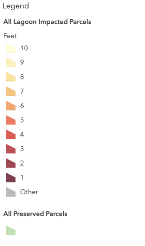
All Lagoon Impacted Parcels – “Feet” is the amount of sea level rise that will impact the parcel.
All Preserved Parcels – Areas shaded in green are parcels included in preserves. There are gaps in this data, it is a work in progress that will eventually show all preserved parcels.

Access Maps
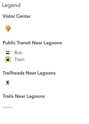
Visitor Centers – Represented by an orange marker, these include lagoon visitor / nature centers.
Public Transit Near Lagoons
- Bus – MTS bus stops
- Train – Coaster and Trolley stops
Trailheads Near Lagoons – The main access points to trails in or near lagoons.
Trails Near Lagoons – Trails near or in lagoons, accessible to the public.