Batiquitos Lagoon
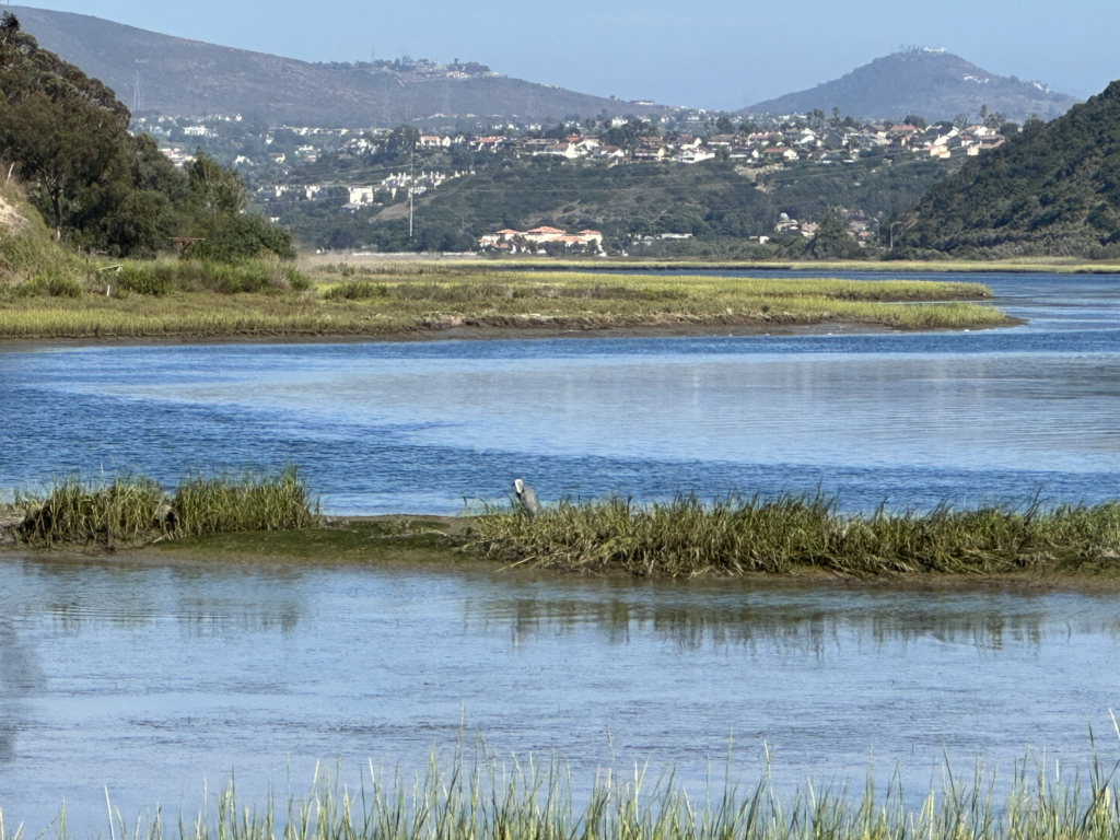
The Batiquitos Lagoon consists of about 610 acres with a drainage basin of about 55,000 acres. The watershed basin includes the cities of Carlsbad, San Marcos, and Encinitas, with its primary freshwater tributaries being San Marcos Creek from the east and Encinitas Creek which flows north along Green Valley, entering the lagoon under El Camino Real and La Costa Avenue, respectively.
The lagoon is owned by the California Department of Fish and Wildlife. Batiquitos Lagoon was acquired to preserve, protect, and maintain the improved coastal wetland habitat and associated species. The property was designated as an ecological reserve by the Fish and Game Commission in 1983.
The Batiquitos Lagoon Ecological Reserve is a 544-acre property protected by municipal ordinances as a game sanctuary and bird estuary. The Batiquitos Lagoon SMCA area includes the waters below the mean high tide line within Batiquitos Lagoon eastward of the Interstate Highway 5 Bridge. This marine conservation area overlaps the slightly larger Batiquitos Lagoon State Ecological Reserve.
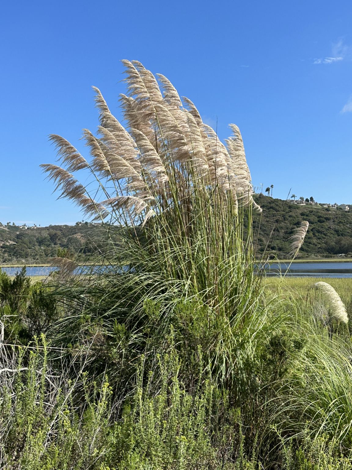
Together, the SMCA and ecological reserve protect many different habitat types, including open water/subtidal, intertidal mudflats, southern coastal salt marsh, coastal brackish marsh, nesting areas, transitional zones, and southern arroyo willow riparian forest. Dominant flora includes eelgrass, pickleweed, alkali health, and white sage. Terrestrial fauna includes raccoon, woodrat, skunk, and ground squirrel.
A wide variety of marine species use these habitats, including striped mullet, horn snail, leopard shark, bat ray, and pipefish. The MPA protects a nursery area for young fish, including California halibut and Pacific staghorn sculpin.
Over 200 species of birds live in this wetland area or use it as a stopover site during migrations. Several bird species seen at the conservation area are endangered, including the western snowy plover, Ridgway’s rail, and California least tern.
Wetland Expansion Potential
Wetland Migration
Sea level rise will initially result in wetland migration into transition areas within the reserve and expansion of wetlands. Later, above about 6 feet of sea level rise, much of the marsh area will convert to open water, and barriers to expansion will prevent further migration. The two parcels acquired in 2004 and 2022 added transition area that will help preserve wetland function, and a portion of the one private parcel adjacent to the lagoon on the north will also allow some migration.
There is one parcel on the south side still in private hands, but it is being acquired by the City of Encinitas. The lower elevation portion of that parcel will also allow some marsh migration.
Constraints
As noted above, some wetland migration is possible on the north side of the lagoon, but it is limited by topography as the slopes rise steeply along most of the lagoon.
Wetland migration on the south side is mostly constrained by steep slopes, or by La Costa Avenue backed by steep slopes. A box culvert under La Costa Avenue near El Camino Real where Encinitas Creek enters the lagoon will allow some expansion into preserved area on the north side of La Costa Avenue.
The eastern end of the lagoon is constrained by El Camino Real except for a culvert where San Marcos Creek enters the lagoon. The creek is constrained in a concrete channel through a shopping center, which would limit eastward expansion. At sea level rise above six feet, there is likely to be some tidal influence making its way up the creek and flooding low-lying land area on the golf course east of the shopping center.
Public Access
Recreation
Runners, walkers, and naturalists will find a haven in the Batiquitos Lagoon. The lagoon can be seen and experienced from a nature trail on the north side. The public walking and hiking trail is about 1.6 miles long. It starts just east of Interstate 5 at the end of Gabbiano Lane and goes most of the way to El Camino Real on the east end of the lagoon. There are five public parking lots providing access to the trail, one by the Nature Center and four on Batiquitos Drive. Dogs are allowed on the trail but must be leashed at all times.
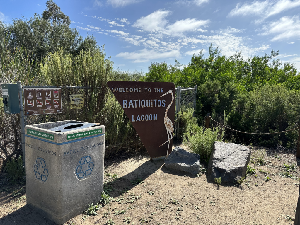
At the trailhead at 7380 Gabbiano Lane is the compact but very comprehensive visitor center with its native plant garden (open Monday through Friday, 9am–12:30pm; Saturday and Sunday, 9 am–3pm). Volunteer docents from the Batiquitos Lagoon Foundation are happy to answer your questions. Brochures for self-guided trail walks are available at the center or in a box outside, and there are helpful descriptive signs along the trail. The Batiquitos Lagoon Foundation offers many different docent-led walks along the trail from the nature center at 7380 Gabbiano Lane.
The Batiquitos Lagoon trail and picnic tables are open from dawn to dusk. The Nature Center restroom and viewing deck are usually open from 9 a.m. – 3 p.m. subject to volunteer availability. For more information visit the Batiquitos Lagoon Foundation website.
For those with a license, fishing is permitted only at the rock jetties at the mouth of the lagoon in South Ponto Beach and the rocks under I-5 (east or west of the freeway, on the north side only).
Club Pelican, a nature and arts summer camp sponsored by the City of Carlsbad and the Batiquitos Foundation, is also held at the lagoon.
Transit
There is no convenient transit access to the western part of the trail. The Arenal Road Trailhead is a short walk from a bus stop at El Camino Real and Arenal Road served by the 309 and 609 bus routes. The 309 connects with the Sprinter light rail at the El Camino Real Station in Oceanside, and with the Coaster at the Encinitas Coaster Station. The 609 also connects with the Coaster at the Encinitas Station.
Closing the gap in the trail would make the entire trail transit-accessible.
Expanding Public Access
In 2022, the Foundation took title to a 7.2-acre parcel of land located at the northeast end of the Lagoon. It lies adjacent to a larger parcel acquired by the Foundation in 2004. Subject to various approvals, the acquisition of the new parcel now paves the way to extend the existing Batiquitos Lagoon Trail eastward and then southward to San Marcos Creek. In 1997, the Foundation created a Batiquitos Lagoon Public Trail Program that proposed route and design concepts for a trail system around the Lagoon. Some of the Foundation’s proposed concepts were later incorporated into the City of Carlsbad’s trail system as outlined in its General Plan, Local Coastal Program, and Trails Master Plan. That municipal plan is also supported by the California Coastal Act. Ultimately, BLF and Carlsbad’s trail plans will provide a continuous walking trail from the beach at South Ponto to El Camino Real along the entire north shore of the Lagoon.
While one privately held parcel still prevents the two parcels on the east end from connecting to the existing trail to the west, the portion of that private land closest to the Lagoon has been zoned open space and cannot be developed. This establishes a protective buffer between future development and the Lagoon itself. As designed, the trail will fit within that buffer. There is also a missing section of the Lagoon trail west of I-5. The Foundation is also working to complete this missing section to make the trail from the Lagoon mouth at Ponto Beach to El Camino Real a reality soon.
Stewards
Batiquitos Lagoon Ecological Reserve – California Department of Fish and Wildlife